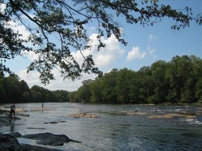
Chattahoochee River Fishing Spot
- Elevation: 2794'
- Last Modified By: vinny60 on 09/08/09 01:39 PM
- Ask about Chattahoochee River in our Fishing Forums
Photos
Fish Species
Comments
-
Have you fished at Chattahoochee River? Be the first to comment on this fishing spot.
Chattahoochee River Description
The Chattahoochee River runs from the Chattahoochee Spring in the mountains of northeast Georgia, southwestward past Atlanta and through its suburbs, then turns southward to form the southern half of the Georgia/Alabama state line. Further south it merges with the Flint River at Lake Seminole near Bainbridge to form the Florida panhandle's short Apalachicola River, and is the largest part of the ACF River Basin watershed. Much of this segment of the river runs through the Brevard fault zone. Unusually, Atlanta is built on a ridge rather than on the river, which has kept much of the natural scenic beauty of much of the section that runs through metro Atlanta. This is so much so that the Chattahoochee River National Recreation Area, spread across several disconnected units, protects many of the riverbanks north of the city. Today, in addition to providing drinking water and power in north Georgia the Chattahoochee is a major source of recreation. Fishing, tubing, canoeing, boating, hiking and camping on its banks, shores, and in its watershed are all popular activities. Chattahoochee River National Recreation Area:The Chattahoochee River and its valley is a place rich in natural and cultural resources. Sometimes the river is clear, cold, and slow-moving, while at other times it is a muddy torrent, plunging through rocky shoals. The valley contains a rich, diverse mix of plants and animals that represent an environment much larger than itself. For centuries, humans have been drawn to this river valley for life’s basics: food, water, and shelter as well as transportation and power to support the increasing numbers of mills and factories. By the 1970’s, the resources that made the river valley a special place to so many people were being threatened. On August 15, 1978, President Jimmy Carter signed the legislation that set aside a 48-mile stretch of river with a series of parklands to preserve a part of the river valley for future generations. Today the river valley attracts us for so many reasons. Take a solitary walk to enjoy nature’s display, raft leisurely through the rocky shoals with friends, fish the misty waters as the sun comes up, reflect on a mill worker’s day as a chipmunk scurries over the paper mill ruins, or have a picnic on a Sunday afternoon. Experience your Chattahoochee River National Recreation Area. Operating Hours & Seasons Day-use only. Park is open from dawn to dark all year long. Dark is defined as 30 minutes after legal sunset and 30 minutes before legal sunrise. Fishing the Chattahoochee River year-round for its trout, bass, catfish, and other species can be a great experience.
The Chattahoochee River runs from the Chattahoochee Spring in the Appalachian Mountains of northeastern Georgia, near the Carolinas, to the southwestward to Atlanta and through its suburbs. It eventually turns to the due south to form the southern half of the Georgia/Alabama state line. Flowing through a series of reservoirs, it flows by Columbus, Georgia, the second-largest city in Georgia, and Ft. Benning of the U.S. Army. At Columbus, it crosses the Fall Line of the eastern United States. Farther south it merges with the Flint River and other tributaries at Lake Seminole, near Bainbridge to form the Florida panhandle's Apalachicola River - the same river, but with a different name, dating back to Colonial times. It is the largest part of the ACF River Basin watershed.
